

Blog
On this day: award-winning innovation in the water industry


Taken from a single flight, we develop ultra-high resolution imagery to provide fast, accurate, and reliable topographic and image data for our clients in the construction, utilities, regulatory service and renewables industries. But to get the most out of environmental monitoring data, the monitoring activities and surveying methods need to be right. Here’s our guide to getting the right survey for your needs.
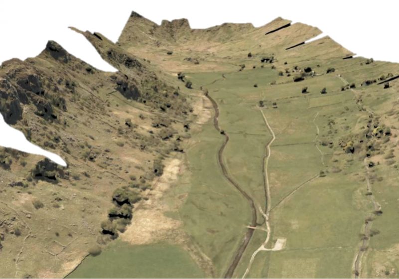
Ultra-high resolution still images that are precisely georeferenced, from which we produce overlapping land imagery that can generate elevation and height models and orthomosaics. For our clients in construction, these data can be used for earthworks calculations and cut and fill analysis, and water companies can use the data for catchment modelling, route optimisation analysis and river restoration projects.
Find out more.
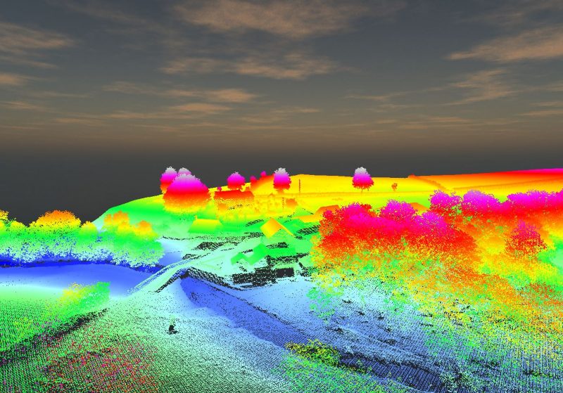
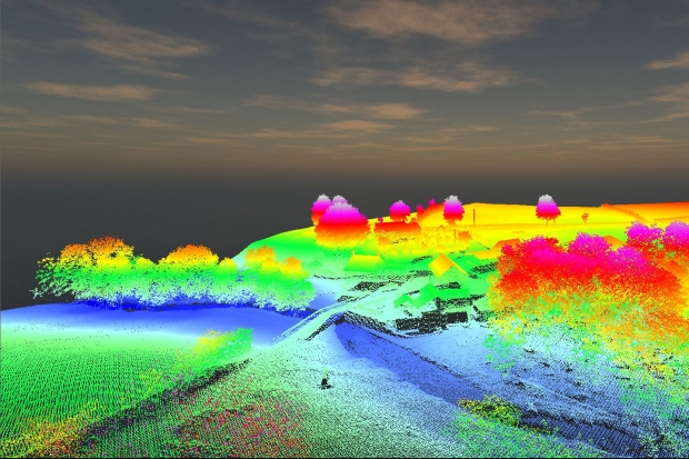
Aircraft-mounted laser technology, LiDAR (Light Detection and Ranging) generates accurate positional returns to give a point cloud of the landscape. Unlike photogrammetry, LiDAR penetrates the tree canopy to get returns from the ground surface below. Clients across many industries use our LiDAR services for projects such as topographic mapping, power line mapping, studies of woodland, archaeology, flood plain modelling, city planning, line of sight analysis and construction phase monitoring.
APEM have recently pioneered other applications of LiDAR to accurately map bird flight heights for the offshore wind industry.
Find out more.
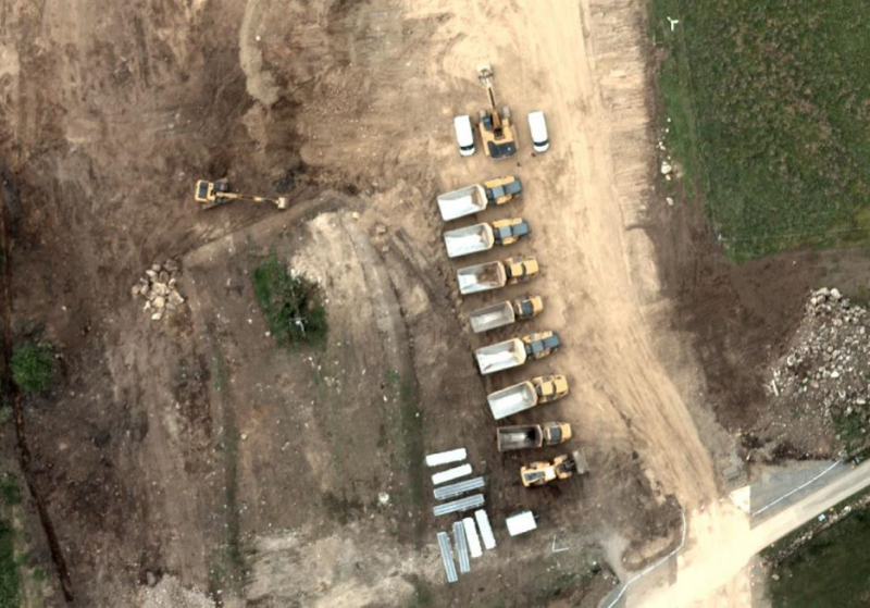
Capturing still photographs at 2cm ground sampling distance (GSD) generates colour images in incredible detail. Images are used to detect invasive and non-native species, identify endangered species in offshore wind areas, vegetation changes to detect pipe leaks and sources of pollution across a whole river catchment. We can also use the data to produce photo-realistic, fully interactive 3D models of the environment and virtual flyovers for stakeholder engagement.
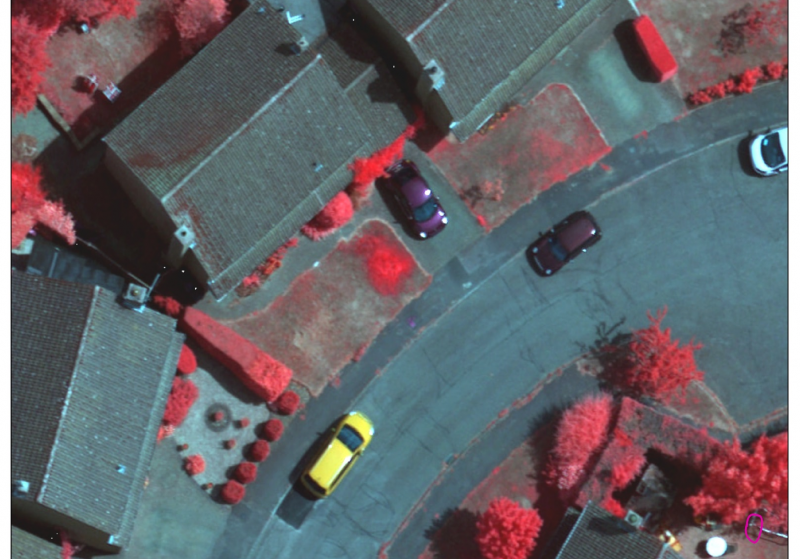
Beyond the visible spectrum, NIR is sensitive to changes in vegetation (healthy vegetation shows up bright red and pink, whereas sparse or water-lacking vegetation shows as a blue-green washed out colour). NIR is used by our clients for habitat classification and detecting pipeline leaks.
Find out more.
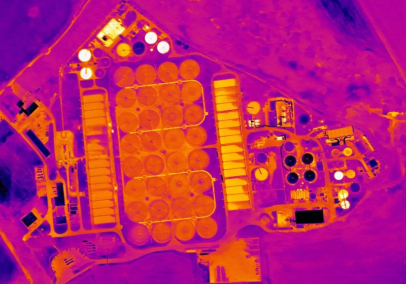
A thermal dataset shows the temperature of a landscape, and is perfect for looking at heat loss and thermal inefficiencies. In the image below, the team immediately spotted a discrepancy in the temperature bottom left filter bed, highlighting an operational problem.
Thermal imagery is typically used in cold, dry conditions, with ideal conditions being from November to February. Our teams are called upon to use thermal imagery to assess heat loss and thermal inefficiencies in residential and industrial properties, as well as inspecting the condition of utility assets such as water and waste treatment facilities, power lines, solar panels and buried pipelines for leak detection.
Find out more.
Generating digital environments
Providing data that is evergreen and reliable, with 3D topographic outputs in a variety of formats, including high density point clouds, digital surface models (containing all surface features of the landscape such as trees and buildings), digital terrain models (using LiDAR imagery, where surface features are stripped out for a bare earth layer), raster elevation maps, XYZ/ASCII grid files, contour maps at pre-defined intervals, reality meshes, VR ready outputs and virtual flyovers.
Tangible exports from survey data
Combining surveying techniques and outputs, we quickly deliver flexible, accurate and robust data that fits in with our clients’ systems and helps drive their business forward.
The team at APEM would be happy to answer any questions you have. Please use the form below to get in touch.
Read one of APEM’s blogs, news articles or case studies to find out more.
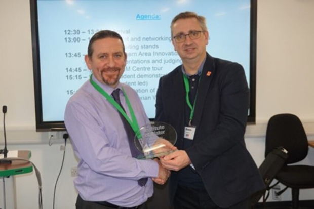
Five years ago, APEM pitched a new idea to an audience of water industry experts – and it was a winning one
+ Read more
The Remote Sensing team at APEM have recently taken delivery of three LiDAR systems to support their services to clients across the globe
+ Read more

The Remote Sensing & Data Operations team at APEM have a new Divisional Director – Andy Gosney
+ Read more