

News
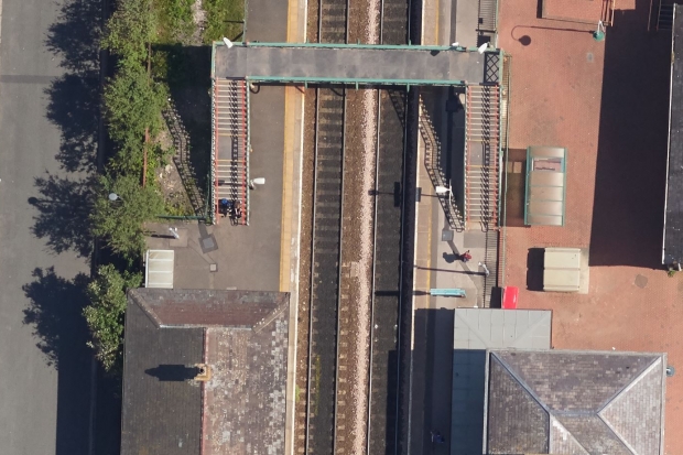
Mapping buried assets from 2,000ft


APEM use specialist sensors mounted in purpose designed survey aircraft to capture high resolution data of the landscape.
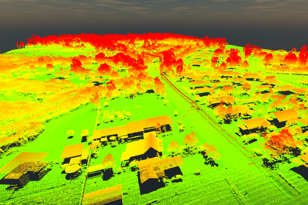
LiDAR technology plus advanced photogrammetric techniques turn the 2D imagery into high density 3D models that accurately map the topography of the site.
APEM are a global leader in aerial topographic surveys. We have been commissioned to undertake aerial surveys of sites of interest by clients from the water and power sectors, the construction industry and government agencies.
Using our specialist sensors and data processing technology, APEM capture a combination of LiDAR and/or ultra-high resolution imagery – better than 3 cm GSD – in multiple wavebands from red-green-blue to near infrared.
We use the data to generate high density topographic models such as point clouds, digital surface models (DSM) and digital terrain models (DTM), as well as accurate ortho-mosaics and photo-realistic 3D models and 360-degree virtual flyovers.
The surveys are carried out by our expert team of technicians, project managers and image analysts, using our state-of-the camera systems.
Keeping the work in-house from start to finish ensures high quality data for our clients.

Our innovative approach to topographic mapping minimises delays caused by land ownership or access issues and reduces the number of ‘boots-on-the-ground’, which is of significant health and safety benefit to our clients.
APEM’s aerial surveys also provide high quality data in remote, inaccessible or hazardous areas. In addition, we can survey either very large areas of up to 200 square kilometres or multiple small sites in a single day.
Our surveys are bespoke and can be tailored to meet your needs. For example, with our in-house processing techniques we can produce point clouds with up to 100 points per square metre – providing an unprecedented level of detail.

The team at APEM would be happy to answer any questions you have or demonstrate our innovative modelling technology. Please use the form below to get in touch.
Read one of APEM’s blogs, news articles or case studies to find out more.

APEM continue to build on their relationship with United Utilities and are ready to help them map a series of buried assets … from the air!
+ Read more
APEM offers H2OVER®, a super-sized, high resolution survey that allows users to ‘virtually’ drive or fly through an area from their desktop
+ Read more
APEM’s Remote Sensing team have been using LiDAR as part of their technology arsenal since 2018 we have recently invested in a further three sensors
+ Read more