

News
Taking responsibility for our carbon emissions and tackling cl...

Celtic Sea Power are working with APEM Ltd to provide robust bird and marine mammal data for the proposed floating offshore windfarm (FLOW) off the Cornish coast.


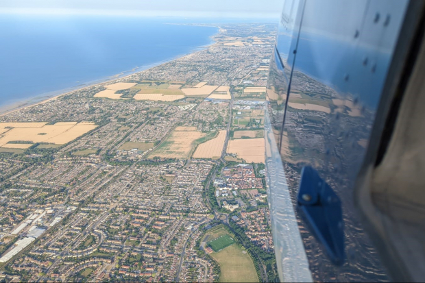
APEM’s initial digital aerial surveys captured some stunning shots of the Cornish coast this summer, including this image of Carbis Bay
The Celtic Sea is approximately 130 miles (210 km) long and 150 miles (240 km) wide, covering a total approximate area of 40,000 square miles (100,000 square km).
At its deepest point at the Mull of Galloway, its depth measures about 576 feet (175 m)1 These depths make the area a prime location to build a floating offshore wind farm.
Celtic Sea Power are working on the Cornwall FLOW Accelerator (CFA), a £6m applied R&D project, part funded by The European Regional Development Fund (ERDF) and part funded by Cornwall Council and is looking to:
Accelerate offshore wind project development, through a process known as zonal planning; mathematically model and provide the hard evidence needed to develop the Celtic Sea’s FLOW industrialisation ecosystem; support the decarbonisation and minimise the energy costs of the regional FLOW sector.
During the glorious summer of 2022, we commenced the first of 4 seasonal ultra-high resolution digital aerial surveys to collect robust data for birds and marine mammals. Imagery captured by APEM will feed into a unique regional bird and marine mammal density and distribution model created in collaboration with Natural England through the POSEIDON project.
For more information regarding this exciting and unique project visit their website.
1 https://en.wikipedia.org/wiki/Celtic_Sea
A certified CarbonNeutral® company, we have now offset 1,376 tonnes of carbon emissions, supporting vital renewable energy projects and tackling climate change
+ Read more

APEM’s ornithology specialists are working on the development of accurate seabird collision rate monitoring technology for offshore wind projects
+ Read more

APEM pioneers the use of Lidar to record bird flight heights
+ Read more