

News
APEM Ltd further invests in LiDAR technology


Our world-class surveying technology and innovative data collection methods are ideally placed to help the construction and civil engineering industries to monitor their projects.
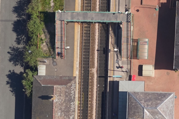
Our specialist vertical and oblique camera systems allow us to create extremely detailed, highly accurate 3D models of the environment.
The use of high-resolution images and LiDAR data captured from manned aircraft makes commercial sense for projects of all sizes, especially when compared to UAVs (drones) or other traditional practices.
Our aircraft can survey multiple sites across hundreds of kilometres in a single day – including remote or inaccessible areas – allowing us to provide a snapshot of an entire group of projects from a single survey. The single source of data helps to reduce carbon footprints and health and safety risks by reducing the number of ‘boots-on-the-ground’ and removes delays caused by land ownership or access negotiations.

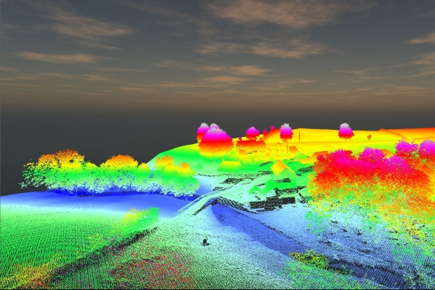
A single survey can deliver multiple outputs. For example, capturing aerial data at 2cm (GSD) can not only provide images at unparalleled scale and resolution but allows us to extract detailed, accurate topographic information about the surveyed landscape. By combining the imagery with the latest 3D modelling technology, we create photo-realistic, fully interactive 3D models of the project.
When used in combination, the datasets provide powerful tools for:
Our 3D ‘reality’ models are fully interactive and allow the user to zoom, pan and fly around the model, providing a unique perspective on the surveyed area of interest. The models help to bring the aerial survey data to life in a web-based environment, accessible by multiple stakeholders at any given time.
Created using high-resolution images, the models are underpinned by high quality, reliable topographic data, giving engineers, ecologists, asset managers the ability to make accurate ‘on-the-fly’ measurements of distance, height, slope and volume.
By utilising the latest Bentley Systems software, we can place project designs into the landscape showing how a final development will look in the context of the real-world environment – perfect for planning and public consultation.

The team at APEM would be happy to answer any questions you have about survey-ing and monitoring infrastructure and developments. Please use the form below to get in touch.
Read one of APEM’s blogs, news articles or case studies to find out more.
The Remote Sensing team at APEM have recently taken delivery of three LiDAR systems to support their services to clients across the globe
+ Read more
APEM offers H2OVER®, a super-sized, high resolution survey that allows users to ‘virtually’ drive or fly through an area from their desktop
+ Read more