

Blog
Risk assessing pathways of invasion


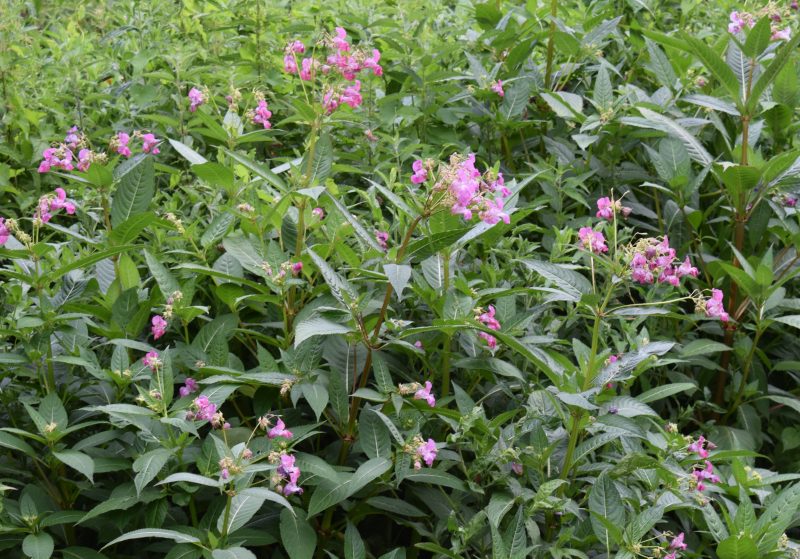
Invasive plant species such as Himalayan balsam, Japanese knotweed, rhododendron, cherry laurel and floating pennywort are a continued threat to ecosystems.
An increasing number of identified invasive plant species have become established in the UK and Ireland and many are causing significant impact that can be difficult and potentially costly to address. These plants put pressure on native biodiversity, especially along linear routes such as rivers, roads and railways, where seeds are easily dispersed.
Such species severely damage native ecosystems and, in the case of giant hogweed, are dangerous to humans.
Many are difficult and costly to control, and some are a particular problem on riverbanks or in aquatic environments because they can be spread by water.
It is estimated that in the UK, invasive plants cost the economy £1.7 billion per year and The Environment Agency estimates that Himalayan balsam now covers up to 13% of riverbanks in England and Wales, with the cost of controlling this one species alone estimated at around £300 million.

The first step in controlling invasive plants is to know where they are. Traditionally this was established by undertaking a ground-based survey, on foot, if access was permitted. Although effective, this approach was slow and often expensive and posed a transfer risk as seeds can be inadvertently spread by staff and vehicles moving between sites.
APEM map the location and extent of invasive plant species in a non-intrusive method from the air using ultra-high resolution digital aerial surveys. Our state-of-the-art digital cameras are fixed on gyro-stabilised mountings on a specialised survey aircraft, allowing us to survey large areas quickly and cost-effectively to a resolution of up to 1.5cm per pixel.
Using specialist software, images captured are geo-referenced and turned into detailed composite images which are then individually examined by our experienced image analysts, identifying signs of invasive plant species, such as the pink flowers of Himalayan balsam.
By overlaying an algorithm that allow us to automatically create maps showing the various types of vegetation across the landscape we establish the location, type and extent of invasive species. Ground-based surveys can then be undertaken to validate and confirm the classification.

Where invasive plant species are already well established, our clients use the maps that we generate to inform their mitigation and management efforts. Where species are less well established, our surveys give our clients an early warning to undertake regular ongoing surveys as a proactive way to prevent the spread of invasive species.
The quality of the ultra-high resolution imagery also makes it possible to map any cracks in concrete or tarmac, as well as collapsed riverbanks or flood defenses. This secondary benefit gives our clients additional added value as the images and data supplied can often identify other issues that they were previously unaware of, giving them an early warning of upcoming issues.
The team at APEM would be happy to answer any questions you have, or to demonstrate our technology. Please use the form below to get in touch.
Read one of APEM’s blogs, news articles or case studies to find out more.

Managing INNS (Invasive and Non-Native Species) is often underpinned by the application of risk assessments to aid in prioritising and targeting management
+ Read more

Small invasive plants are often overlooked as site managers target large dominating species we explore the threat posed by little plants
+ Read more