

Blog
H2OVER® – going above and beyond


APEM’s specialists use ultra-high resolution aerial images to map habitats on land, along coasts and in rivers.
The images are gathered using state-of-the-art cameras mounted on specialist survey aircraft and are evaluated by our experienced in-house image analysts. The resulting maps detail a wide variety of different habitats.
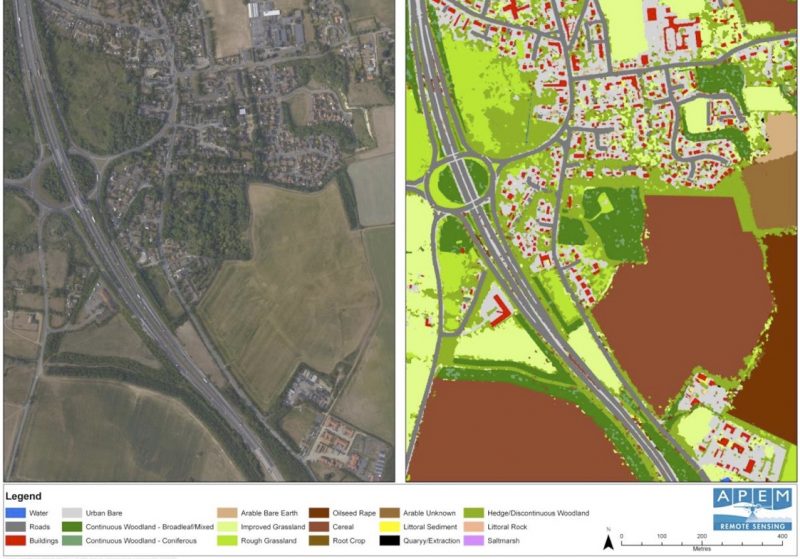
Aerial surveys and satellite data are excellent for mapping terrestrial habitats, particularly if large areas need to be mapped. With our methods, collecting the data is quick and efficient and allows instant access to hard to reach or private land.
The APEM team use a modified version of a phase one habitat investigation to allow classification of habitats using the imagery captured during a survey flight. This is often undertaken as part of a supervised classification, where training data for specific habitats is used to help the software ‘learn’ the various spectral properties associated with a particular habitat.

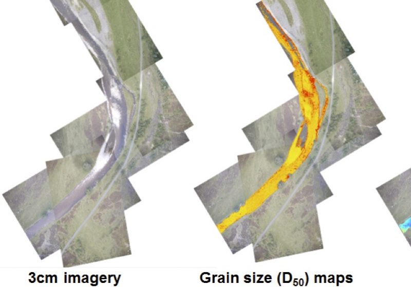
For ‘in river’ habitats APEM scientists have developed bespoke software specifically designed to derive riverine habitats from aerial imagery. The software can automatically classify important habitats such as salmonid spawning and juvenile habitat.
At the same time, the software also produces bathymetric maps of the river and maps showing sediment grain size distribution, allowing precise and auditable statistical data to be extracted from the imagery.
This type of mapping is often used for low flow studies or as part of an environmental impact investigation.
Ultra-high resolution digital aerial surveys and satellites are an ideal way to gather data in coastal and estuarine environments, which can be inaccessible and dangerous on foot.
Aerial and satellite data are used to map the extent and distribution of different sediment types, as well as other habitats including intertidal biotopes and features of conservation importance, such as intertidal Sabelleria reef and eel grass.
APEM often combine aerial surveys with ground validation surveys, which together provide a detailed and robust dataset. The aerial surveys mean that field teams on the ground can be targeted to where they are needed, making surveys more efficient and saving time and costs.

The team at APEM would be happy to answer any questions you have or provide a demonstration and sample images. Please use the form below to get in touch.
Read one of APEM’s blogs, news articles or case studies to find out more.

APEM offers H2OVER®, a super-sized, high resolution survey that allows users to ‘virtually’ drive or fly through an area from their desktop
+ Read more

APEM continue to build on their relationship with United Utilities and are ready to help them map a series of buried assets … from the air!
+ Read more